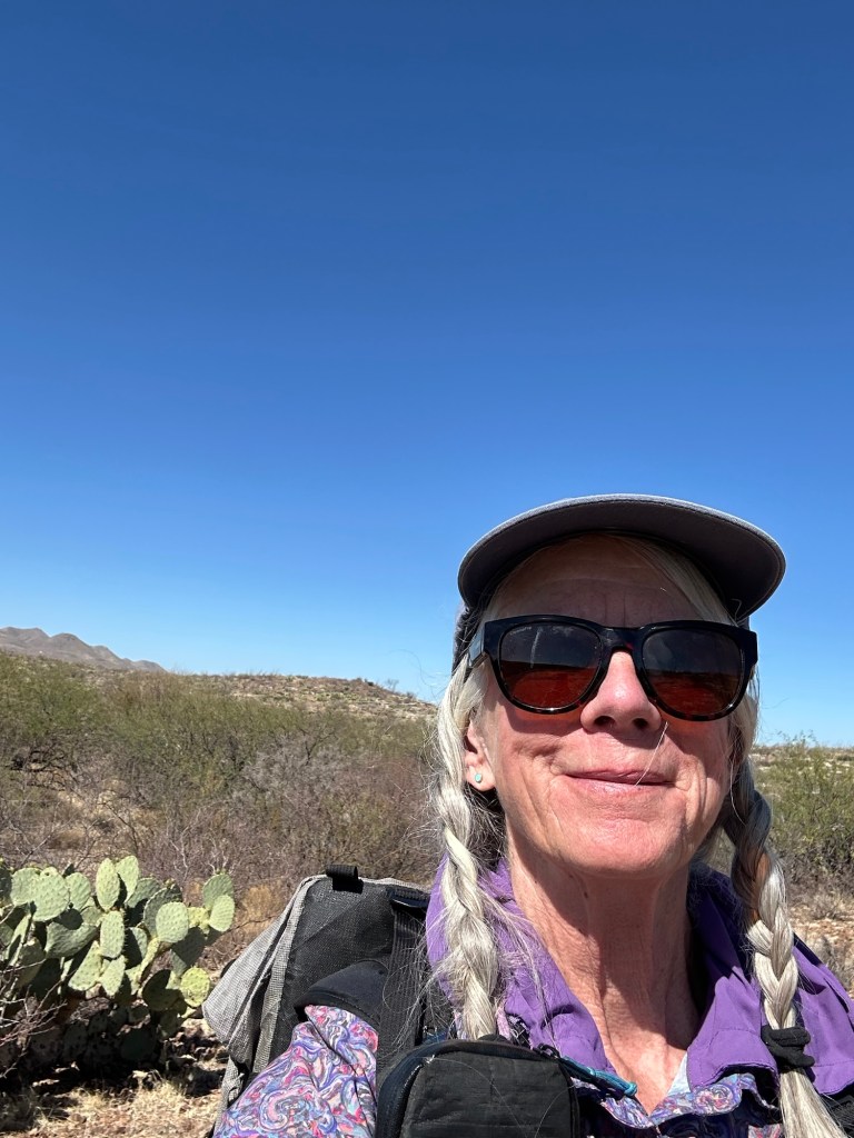
I really enjoyed the Mt Lemmon Lodge in the cold weather. This time of year, not many people here in this beautiful wood lodge so there’s no place open for dinner, just breakfast and lunch, but the general store across the street has food to heat up or you can save lunch for dinner. It all worked out.
Meanwhile, it turns out that the old AZT route ahead is good trail, has less pointless up and downs (PUDS) than the current official AZT, and exists on the AZT paper maps from 2022. It does not have anything more than a dotted line on the FarOut app. So I walked it, the Oracle Ridge Trail to the AZT to Cody Trail #9 and another 3 miles to walk into the town of Oracle where I got a room at El Rancho Robles. This stretch dropped down from the mountains into the flats and increasing heat. As I popped out on a road in town, Gary, a local trail steward, stopped his truck and offered me a lift the short distance to the rancho. When I checked in, I asked Judy where the nearest food was. She offered to fetch up a burrito and bring it back to me. When she returned she handed me Dos Equis beer with a real lime to slice. Perfect day!
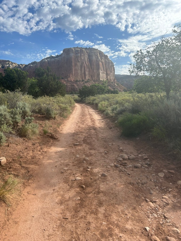
Big rocks made of small round rocksI don’t mind wide dirt road
5/9 13.8 miles
The combination of hauling a bunch of water weight and the increasingly hot day was a bit scary. After getting within 4 miles of the next water source, as I planned, I nearly passed out setting up my tent in a soft, sandy wash. I’m hydrated but there is no shade in this version of the desert so I really can’t cool my body temperature much except by stopping moving.
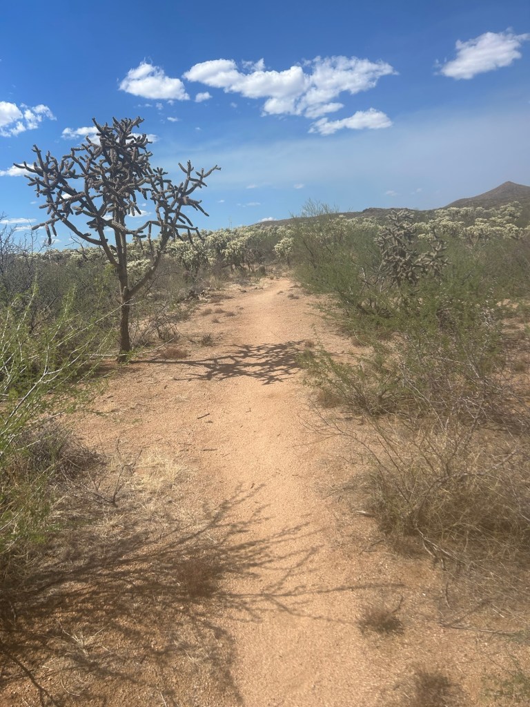
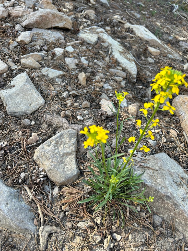
Cholla cactus
5/10 12.1 miles
The heat is hard! I started at 6:15 uphill, in wind, that helped, but by 10:30 it’s killer, no shade.There are bunnies and deer today. And cows. Hit my last water source, loaded up then walked uphill a few minutes to leave the cows and bees surrounding the water tank. I’m sitting in my tent, the only shade, sweating and waiting for the sun to set.
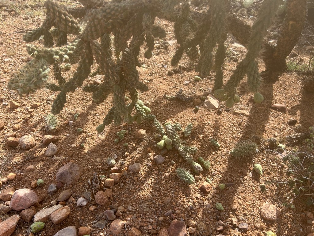
Stupid cholla cactus balls everywhere! They stick to my shoes. Then somehow I got 1 stuck to my wrist and watch. Painful and hard to get multiple spines out at once. My wrist is a bit inflamed and bruised.
I just can’t do the miles in this heat. I get a bit dizzy despite proper water intake.
5/11 15 miles Mother’s Day
I met hikers today! At a water source, German couple Simone and Nils were heading south to then head east on the Grand Enchantment Trail (GET) for about 3 weeks. It started cloudy and less hot and mostly flat today. I made a few more miles because it’s less effort than walking uphill. I needed to get to a junction where there was a roundtrip of 0.6 to a cow trough full of clear water.
Flowers!BunnyCholla balls of fire
And I’m sweating in my tent looking ahead at the options to get into the town of Kearny that has a reputation for being hiker friendly!
Because of the requirement to camp at designated campgrounds in Saguaro National Park, the extreme heat and the 14 miles of relentless, steep uphill, I decided to camp just before the park boundary.
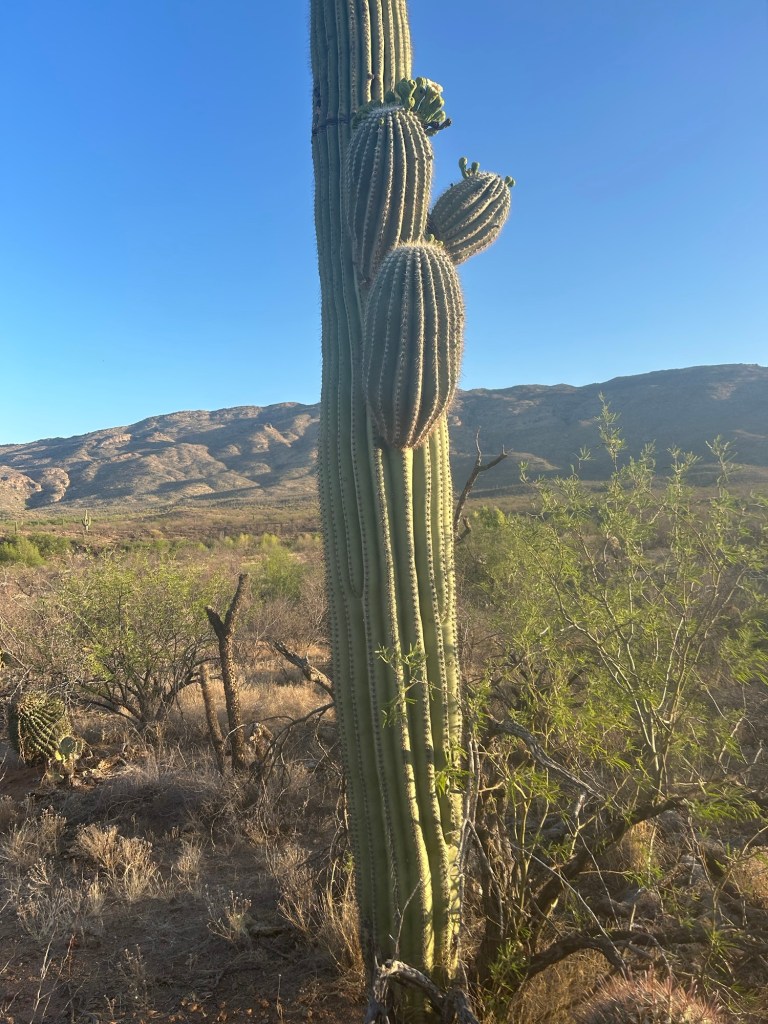
I also carried 5 L of water again. Today was flat. Tomorrow begins more insane ups like Day 1. I plan on 5 days to Mt Lemmon and the southernmost ski area in the US @ 9000’ where it is reputedly always much cooler than Tucson.
5/2 9.3 miles
Well shit, camped early again, too much uphill! But for the first time on this trail, I camped near other people. On the way up I met Dawn, a section hiker! We camped at Grass Hut CG and found the few remaining pools of water to refill our bottles.
5/3 15.6 miles, 6:15-5:30
I was woken at 9:30 pm last night by headlamps and loud voices, a couple had just hiked in to the campground in the dark and obviously didn’t see my tent slightly tucked away. “I’m trying to sleep!” I yelled after a while. A woman’s voice started babbling apologies about not seeing me and I just let her run out of steam and then they quietly finished setting up camp. I had to walk by them in the morning to get on the trail so I tiptoed by. Dawn had gone by before me anyway.
It was another brutal day. 6 more miles uphill past the other designated Saguaro NP campground, Manning Camp, another beautiful, historic set of buildings. Then the rest of the day was pretty much downhill on loose rock and gravel. At least I could breathe while slipping my way down to the lifesaving water cache at Redington Road. I gathered my usual 5 L to get me through tonight and tomorrow, walked across the road and found a lovely cow flattened tent site with some wind breaking thorn trees. Not too much noise from the road, and just a little gunfire in the distance.
2 miles before the water cache, I walked down into a sandy wash as a ranch truck towing a horse trailer was backing up to the trail crossing. Simultaneously, a burro bellowed and got to her feet. I’d been following a set of smallish horseshoe prints and a large trail runner shoe print since the other side of Saguaro NP. 6 cowboys got out of the truck and said she’d collapsed earlier and refused to get back up and go on. Her human (who didn’t ride the burro, but walked alongside her) called for help so they were going to load her up and help her recover.
5/4 10.4 miles
I’m worn out! I got to Molino Basin CG where the trail crosses a highway running between Tucson and Mt Lemmon/Summerhaven (way uphill). The campground is closed for the summer because it’s supposed to be too hot to camp. Of course today the weather has been threatening rain and cold, with near freezing temperatures predicted higher up the trail, as was the weather prediction days ago. As I walked, I kept devising plans and alternate plans. My first idea was to camp at the campground, then hitch up to Summerhaven in the morning and take a double zero to recover and let the weather ease up. Or second, hitch down to Tucson and Uber up tomorrow. Nowhere in my plots was I going to keep hiking straight uphill into weather.
I wandered a bit and Wally, the CG host, thought it’d be a lot easier to hitch into Tucson than uphill. So it took a while but finally Michael, who’d been day hiking while nursing a climbing injury, came back to his parked car and gave me a ride downhill. I googled a $99 hotel, washed up, put on warm clothes, ate dinner at the hotel, and scheduled an Uber for checkout time the next day. Platinum blazing again, what a wimp.
5/5 zero
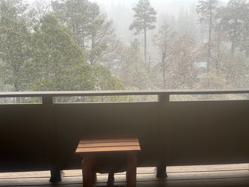
I checked in to my 3rd floor room at gorgeous Mt Lemmon Lodge and watched the snow fall from the window.
At the border between Colorado and Wyoming I had had a brief talk with two guys who were about to hike the Colorado section of the CDT SOBO, they’d done Wyoming the previous year. One of the guys jabbed his thumb at the other guy and said, “He loved Wyoming, I hated it,” and that statement stuck with me because I was so sick of Colorado, and was so looking forward to different terrain in Wyoming–the Red Desert, the Wind River Range. And a night and day later, the country WAS different and I joined the Fans of Wyoming club. The CDT is a weird beast and state lines are imaginary lines drawn by surveyors, you’d think. So how could Wyoming be so distinctive from Colorado? I didn’t know much about Wyoming before hiking through it, in fact I had to buy and mail myself a road map so I would have a clue. I’ve read all the Craig Johnson novels in the Longmire series and watched the whole TV series, that’s about it. But of course Wyoming figures prominently in the history of the American West. What I will research over the winter, what I want to know about, are the first people who were here and the people who are now on reservations. The little towns I’ve visited in Wyoming present as overwhelmingly white, and since I’m a white person you’d think that would not be uncomfortable. But when I went home and landed in Anchorage, Alaska, my home for 25 years and walked through the airport, I realized that was the reason Wyoming felt odd, it was white. In ANC I was home–the concourse was filled with Alaska Natives of all affiliations, and Pacific Islanders, and people speaking assorted European and Asian languages. I have often told the story of the first phone call home from my white boy son 3 days after he went to college in Bozeman, Montana. “Mom? It’s so weird here, everybody is white.”
I took it in steps, leaving the trail unfinished, like the neighborhood kid game we used to play called “Mother May I?” Yes, you may take 2 baby steps–2 nights in Dubois, WY. Yes, you may take 1 giant step–1 1/2 hour shuttle ride to Riverton Regional Airport. Yes, you may take a flight to Denver. Yes, you may fly home to Alaska.
It would have been easier to justify to myself if the weather was horrible or I was injured. But what I wrote in my journal was:
1. I am exhausted.
2. I am depleted, even the tightest pair of jeans I’ve ever bought, hang on me.
3. I’m lonely hiking on my own.
4. Winter is coming.
5. I have to go volunteer in Yosemite.
6. I miss my cats, um, and my husband and friends.
7. I have no voice, I have to get my vocal cords scraped again.
8. My ankle has not healed from rolling it in Colorado in June.
9. I have to train to RUN the NYC marathon November 5.
10. My sleeping bag stinks even though I use a bag liner.
These are all true. But it’s no easier to be a quitter. I can’t call myself a thru hiker any more. Oh wait, I just call myself a hiker anyway.
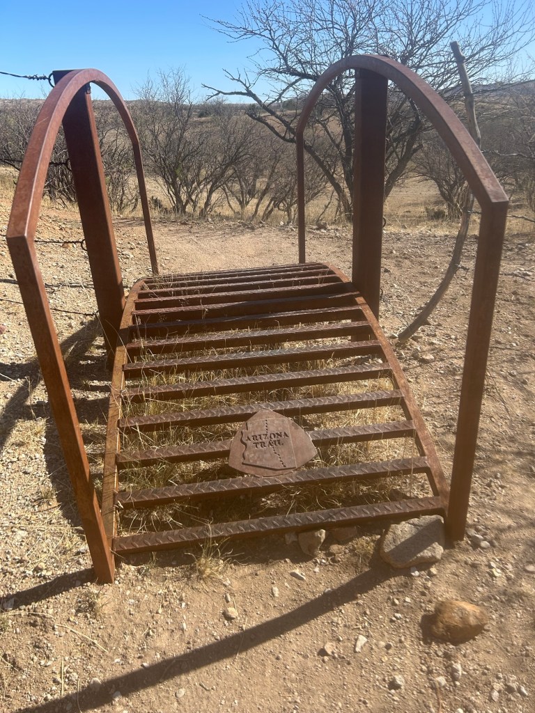
This is a “rollover” gate to make it easier for bicycles than some kind of latched gate
4/25 zero
4/26 15.1 miles
The water issue again. I hiked till there was a source, then I camped. Today I saw 14 cows, 2 day hikers and a cyclist going the opposite way of me.
4/27 14.1 miles + 1
Just a little bonus mileage for today since the FarOut AZT app didn’t show the icon for a gravel road to trail junction. Fortunately when I realized it, I saw an old abandoned ranch road and traversed it back to the trail past a cow pond water source.
There are these resupply boxes, bear lockers, periodically near trailheads, stocked with gallon bottles of water for hikers, some private, some for any hiker.
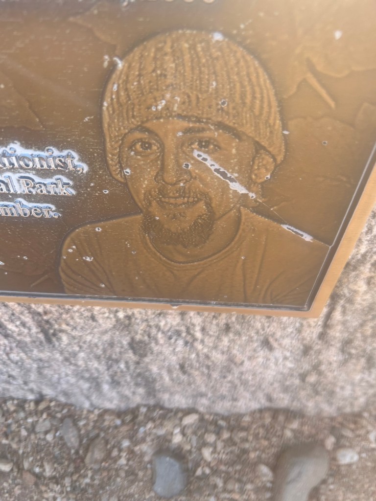
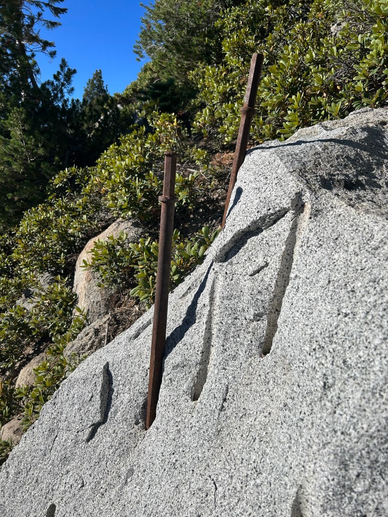
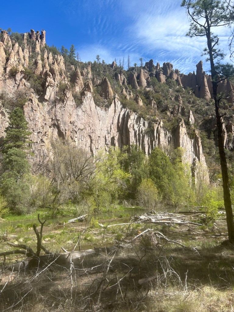
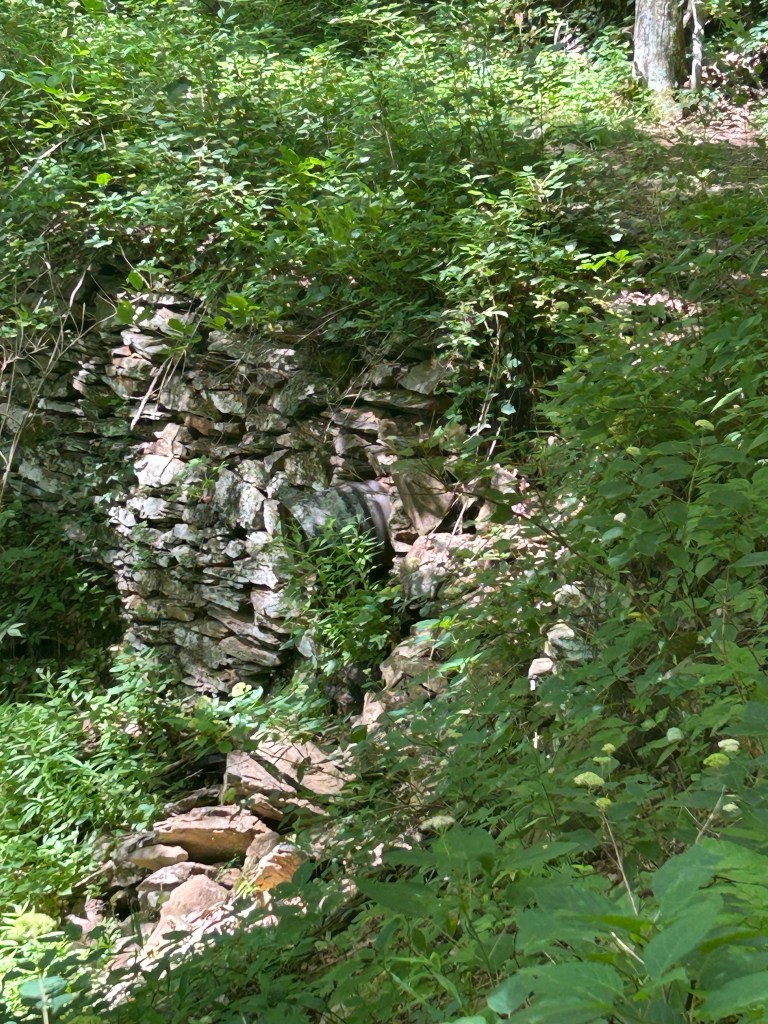
After the first one, 6 miles in, there were a series of very cool historic plaques. Generally you only run across these where a project has occurred that required disturbing or destroying federally designated and protected historic properties on the National Register of Historic Places (NRHP). Tear down old historic buildings or infrastructure and “mitigate” the negative impact to the historic property by installing interpretative displays describing what used to be there. Santa Rita Water and Mining Company invested massive amounts of money in 1904-5 to build a hydraulic gold mining system. Turns out there wasn’t much gold here so the project was abandoned. Guess there weren’t any Mini g Geologists in those days. Anyway I love old rusty objects and other relics of human activity and the interpretative signs along the way gave me a lot to think about.
I went through another gate, and leaned against a little tree when I saw another first coming at me: 4 people riding donkeys! Donkeys?? Plus 1 on a horse.
4/28 12 miles
Including carrying 5 L uphill the last 4 miles to camp. And more cyclists, cool!
4/29 13.5 miles
AirBnB Joanne got me from the trail and I’m staying in her spare room in Vail. She has a wonderful dog, Hachi. It was a super hot day walking down into cartoon perfect desert, flat. All I saw today was 2 day cyclists and 5 horse riders. Tonight a Big Alaska Snowboard & Freeski Club Board meeting via Zoom. I washed up and put on an Aloha shirt with a fern background on the screen, but was so tired, I barely said a word. Lucky Board members!!
4/30 10 miles slackpack
Joanne dropped me off and picked me back up later in the day. Pretty quick miles in the flats. I saw a runner, a cyclist, 2 bunnies and 1 squirrel. The FarOut app was confusing again as I tried to find the Colossal Cave gift shop to pick up my resupply box. 2 tourists tried to help, then a park guy stopped on the road and gave me a ride off trail in time (before 3 pm closing!) to get my box.
“Thanks bro, what’s your name?” I said to the young guy.
“Mike,” and a handshake.
“I’m Catwater, and you’ll wanna wash that hand now,” I said with a grin.
I got my box, ordered a prickly pear margarita and a pretzel dog—delish! Then Joanne got me, we went shopping at Safeway, and I settled back in at her air conditioned house with Hachi, a guest dog, Cholla, and an IPA.
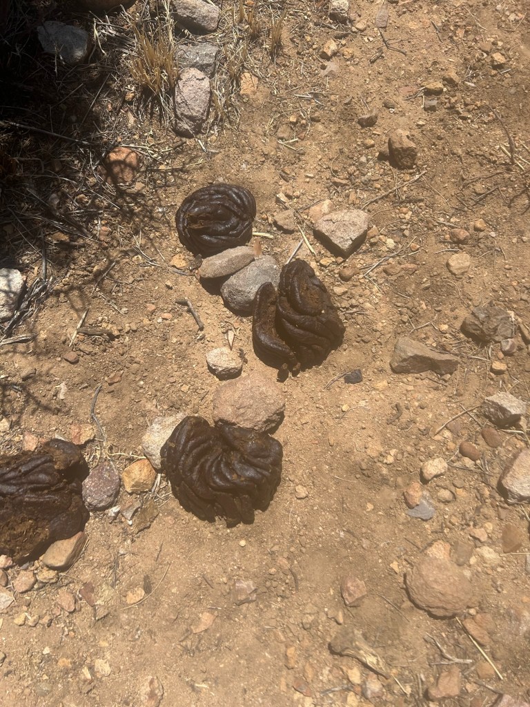
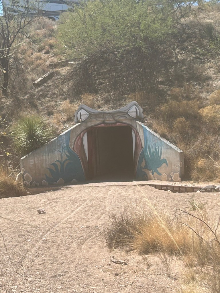
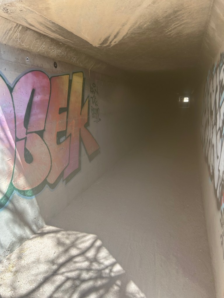
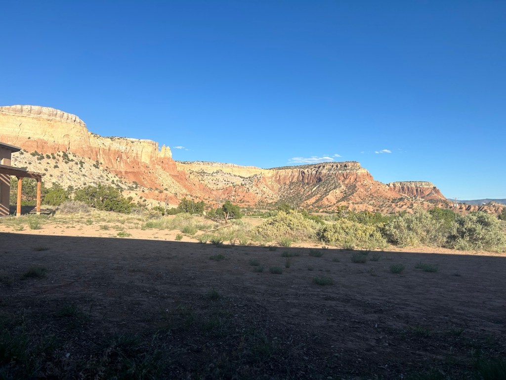
Just showing the perfection of a coiled cow poop100 mile marker, just like the PCT in 2015And under the highway I goA beautiful tribute to Jake Quilter at a trail named for him
I started hiking the Arizona Trail from the border north…uh, whoops, I turned around out of the falling snow after contacting True North who had just dropped me off after the 2 hour shuttle from Tucson airport. Jenn came back to the trailhead and took me to the Hampton Inn in Sierra Vista where I finally warmed up and took off my down jacket.
4/20 Day 1 (9.8 miles) The next morning, 420 and Easter Day (I had some hard boiled eggs for breakfast, does that count?) I got an Uber to the Coronado Visitor Center and started uphill under clear skies. Today was 10 miles from about 6000’ to 9000’, 8:30-5:00. I got to the water source at last, Bathtub Spring, loaded up on water to get me into the next day, and found a campsite a ways uphill. It was cool, but not cold. I set my tent just below the ridge out of the wind but facing east for the morning’s warming rays. Quiet, peaceful, lovely.
The beginning days of these long hikes are always going to get me, so I plan shorter mile days and carry an extra dinner just in case. But today was still weird. Border patrol in vehicles and tramping the trail. Day hikers coming down the trail.
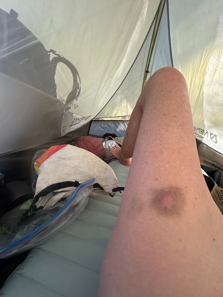
A dad leashed his Aussie as his family of 3 came towards me. The dog nipped me anyway after the humans said hello, fortunately I was wearing my tights so she didn’t break the skin. Dad said, “she’s never done that” and actually looked stunned (also military). Later I wished I’d told him that sometimes dogs weirded out because a hiker had hiking poles (clicking or just looking like weapons? I don’t know.) I felt bad for the dad actually, and tried to tell him it was just a dog being a dog. I’d forgot the hiking sticks and non-trail dog aberration. Still, I have a lovely bruise 5 days later.
4/21 (13.8 miles) was less strenuous, downs as well as ups. It did get quite cold last night, but my layers worked. Today I wore my trekking tights till 11am, fleece till noon. Having to carry water and think about where to camp is a pain. Camp too early to be close to water, or pick up enough to get me to the next day and how ever many miles to the next source? Water is HEAVY.
The Uber driver was a hunter and told me about some of the animals I could hope to see in the Borderlands. I saw a deer, 3 turkeys, an AZT hiker, an OG doing an overnight out-and-back hike, 1 Park guy, and 2 Border Patrol. Yeah, counting living things as I walk is a thing.
And I fell down in the flats, 2 scraped knees dammit. If it wasn’t for the wrinkles and gray hair, I pretty much look like I did in 6th grade now. I picked up water at a cache near a road and stumbled on to find a campsite. I’m starting this trail relatively late in the season, so the water caches might be good (never count on them though, as we hikers on the Pacific Crest Trail (PCT) were told over and over in the desert of So Cal.
4/22 (12.4 miles) Saw no people today. Rocky, gravelly ups and downs. Warmer but with a breeze and scattered trees with shade. I took a zillion micro breaks. The 10 miles steep uphill on Day 1 really worked my calves. No injury, I just should have attempted to stay a little fitter this winter, my bad. I found another little campsite in line for morning sun after loading up 5 liters at a water cache to get me to the next source in 7 miles tomorrow.
4/23 (11.1 miles) I knew I wanted to get to Patagonia tomorrow, so I left a few miles to go, and camped early.
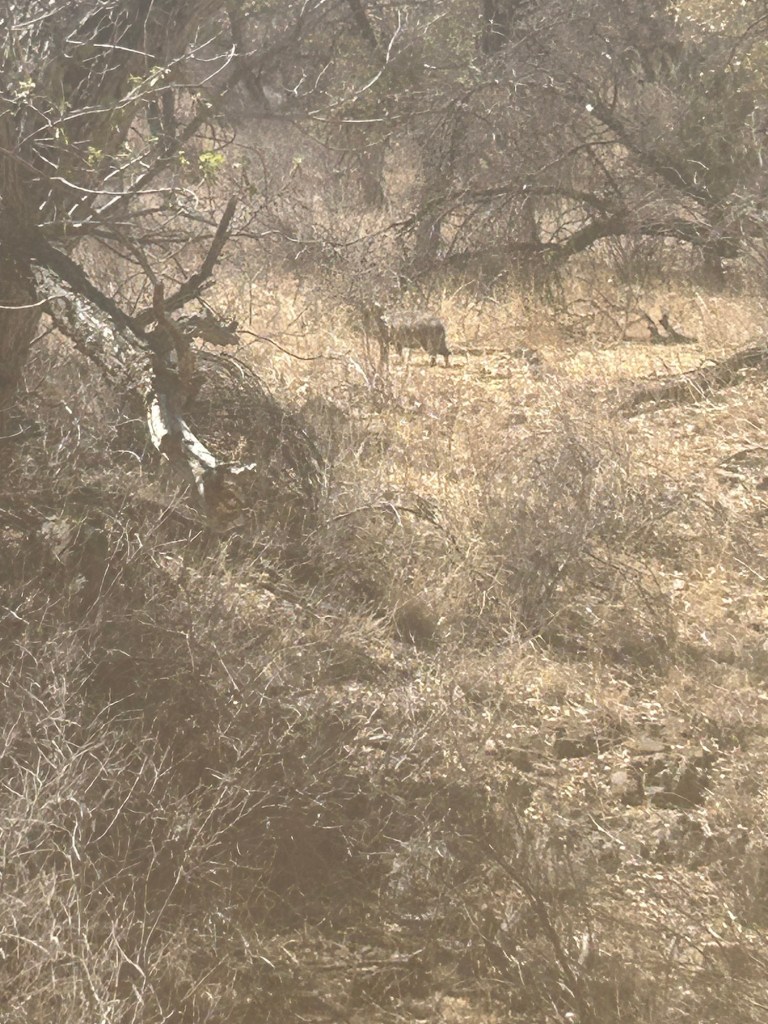
I saw my first 3 javelinas today! The photos suck, shooting into the sun. When they saw me, they each ran off a few yards, then froze, looking back at me. And seeing them explains the confusing scat I’d seen earlier. Looks like berry filled bear scat kinda. But no bear tracks. Ahhh, those small cloven hoof prints! Javelina!
.
Hazy javelina
Also a cyclist, Jacob, came by. I’d seen bicycletracks ahead of me, so I knew it was a thing. And a Great Blue Heron I startled at a cow pond.
A good day, warmer yet again but the breeze on the ridges helps a lot. And tomorrow I have a reservation for 2 nights in Patagonia at the Stage Stop Inn.
4/24 (7.6)
Well the trail must have been easier cause I got to the road to Patagonia by 11 am. Based on comments in FarOut, I decided to call the Inn and see if someone could come get me, rather than hitch into town. Owner Jerry came right away, and since it’s apparently slack season, my room was ready so I was all checked in by 12:30. Shower, laundry, restaurant, post office to pick up my box.
And then real food! Chicken fajita tacos, coleslaw, Mother Road Turbo Tower Station IPA. The simple joys. Now to rest up my legs and back. Water is HEAVY….
Well not the Loop meticulously put together by Brett Tucker and Melissa Spencer, check out simblissity.net for their other routes too, like Lowest to Highest ( L2H), Mogollon Rim Trail and Grand Enchantment Trail (GET).
I got to Santa Fe after learning that the Indios Fire had shut down a portion of the CDT, collocated with the Northern New Mexico Loop (NNML) between Cuba and Ghost Ranch. If I started out of Santa Fe, I’d have to add the 31-mile reroute along 2 highways. I decided to start 155 miles in, at Ghost Ranch and found Kevin to shuttle me, stopping to pick up another couple going to Ghost Ranch along the way.
It was insanely hot at Ghost Ranch as I hiked uphill to the CDT. To get water for dry camping, I had to gently ask permission of the cows and calves crowded around the water tank. They gave me the look but let me fill my bottles and move along. You really need to be courteous and camp well away from their territory, scaring them away from their water could be a death sentence. I found a campsite uphill from the trail and as it got dark there was the usual single cow kind of yelling to find where the heck the herd was bedding down for the night.
A couple more nights on the CDT, but when the hail and lightening hit I camped early and inReach texted (Mitch) Tumbleweed Outfitters in Chama to pick me up from Hwy 64 the next afternoon. And it was cold in the morning, wore all my layers for hours. Got to Chama and it rained some more and all the next day. Yuck.
David Odell’s 1971 transcribed paper journal from the Continental Divide Trail (CDT) provides quite a contrast to my current experience. Rereading this Triple Crowner’s journal section for the New Mexico part of the CDT, as I hiked here, I was struck by how he had to navigate from maps to try to find routes that would have him hiking on the Continental Divide Trail (CDT). The official CDT, 50 years later, now seems oftentimes to be a long way from the geographic continental divide.
His paper journal from 1971 (!!) has been transcribed by his wife to Postholer. As have his 1970’s Appalachian Trail (AT) and Pacific Crest Trail (PCT) paper journals. I was backpacking since childhood but never had an inkling that people were walking for months on end from Mexico to Canada. Reading his journals, I can’t help thinking about what I was doing as he was spending months on a trail. “Fascinating,” as Mr. Spock would say.
I bought a new fleece pullover made by Tumbleweed and mailed it home at the post office just across the street. And met Toe who knew some stories about Catwater from Puff Puff who hiked the AT with Toe!
Toe and Catwater
Chama to Questa
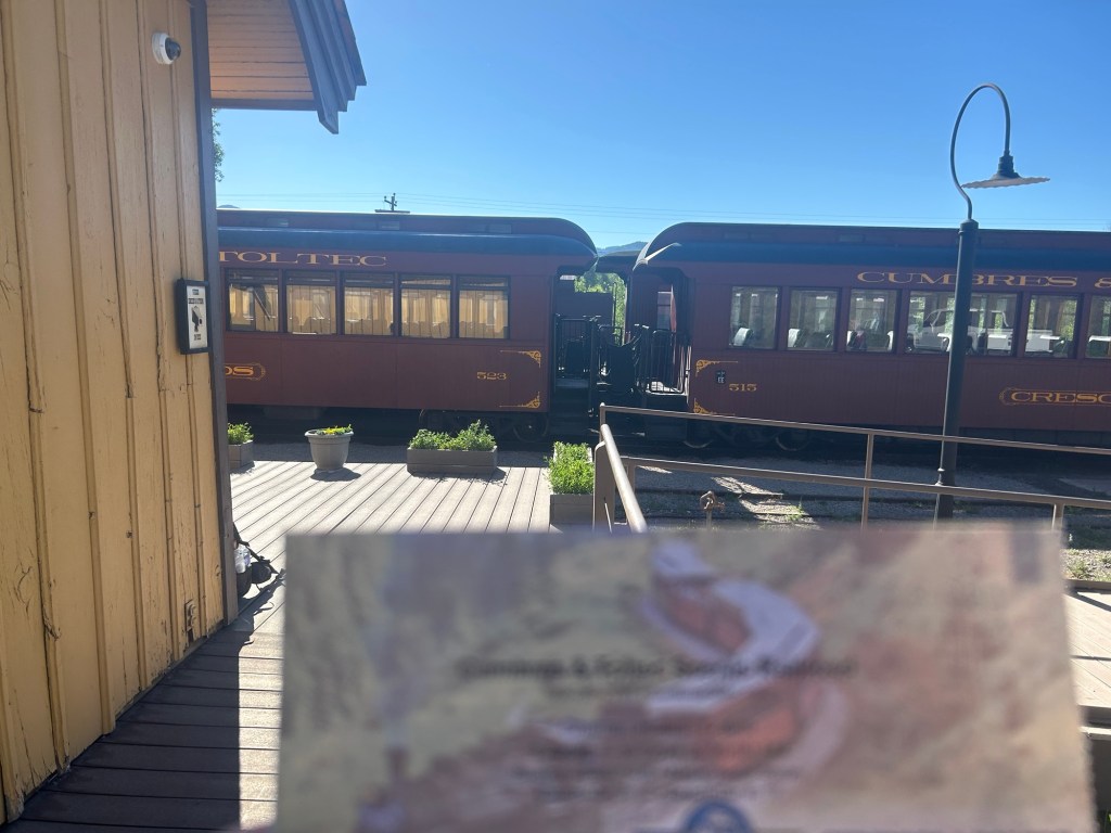
Fun time: I took the Cumbres and Toltec Scenic Railroad to Osier Station and started hiking at 1:30 pm. Every other passenger got back on the train after a yummy lunch. I walked 5 miles to the CDT, then decisions to make. The NNML goes cross-country (x-c) a ways down the trail, or I can make my own route via the CDT, dirt roads or x-c. I camped at 5 pm with 5 miles left to where I really had to decide how to hike to Questa, after wandering in circles a bit, which is stupid. Part of the challenge is using Gaia GPS with downloaded maps because I’ve just been using the FarOut trail app for so long.
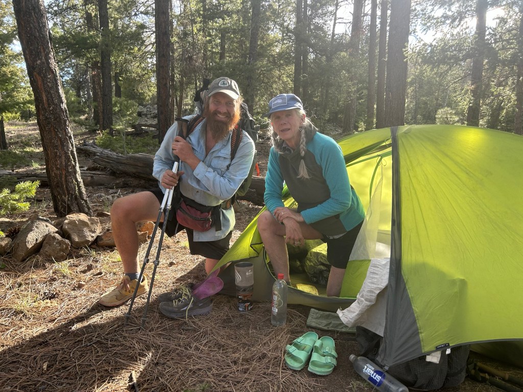
The next morning I walked 3.8 on the CDT to the Brazos overlook where the x-c began. I saw tons of elk! I sat and contemplated my options, searching FarOut maps and the Gaia maps. Nope, I decided to take the dirt road, Forest Route 87, that parallels the CDT to Lagunitas Campground. I’d connect in about 11.25 to the NNML. About half an hour into the road walk, “Bandit” on a bike comes my way and says “Old Timer” is right behind him. I saw him and yelled “OT!” Astonished, he hopped off his bike, we hugged and talked. OT was in the group I was hiking the CDT with in 2021 from Mexico to Grants, along with the Warrior Expedition guys. He asked me, as in 2021, if we could pray together. I look into his eyes, the kindest soul, this man. I told him how hiking with the veterans that year changed me. He unpinned a small cross decorated with the American flag colors and handed it to me. He had told bikepacking buddy Bandit he would run into somebody he knew on the trail. More hugs. He and Bandit rode on north, I hiked south.
And I continued, realizing I have made my own alternate to the NNML, quite happy with it too.
My campsite after 18.2 miles was cool and quiet, with mini worms dropping on my tent. No cows around, but I heard an annoyed elk walk by.
The next morning, it was a short walk along trail back to FR 87 which I opted to stay on till Hwy 128 and then to “unimproved road”. I didn’t want to spend time bushwhacking (x-c), especially up higher when the wind is already ferocious and it looks like rain. I did use my brain to walk way off the road to the Rio access to get 5 liters of water to get me through a long waterless stretch. Old barbed wire fence that I had to go under, the bottom wire was barbed so I have a couple more scars in development. The barbed wire they’ve got further south in New Mexico has the unbarbed bottom wire that’s much easier to snake under. It poured rain for about half of the day’s 19 miles, but the footing was easy.
Back to the NNML, I navigated x-c across miles of beautiful sage covered open country. The surface was sandy silt, no shade, slow. I rolled my ankle a bit, it’s fine. Really glad I know basic navigation and had hauled those 5 liters of water yesterday. I finally got to a stock tank about 4 pm? Cows were curled up like kittens, maybe 2 dozen. They freaked and ran for the hills. I grabbed 3 liters and left, treated it once I was out of sight, poor cows didn’t do the usual paparazzi thing, where they stop and stare at me like they’ve been waiting for hours for such a sight. I camped behind some sagebrush, they smell so good!
Whoa. The Rio Grande Gorge at Sheepherder’s Crossing, an historic trail used by sheep herders in the past. I tried to ford, pack unstrapped, but retreated when the water went to my pits. I walked upstream and fell in the river when I slipped on a mud slimed rock, my right hip will have a gigantic bruise, it hurts. I went a bit more upstream, keeping my waist belt cinched. I stepped in and floated, my pack floated too, it was just a short way to the opposite shore, so I went with it, holding my sticks in one hand and rolling to my side and back as I drifted downstream, kicking to the opposite shore. It worked, I’m clean. I only lost my sunglasses. The water was warm, my inReach and phone and most everything else in dry bags survived too. Thanks OT for the prayers.
I climbed up to a paved road with a picnic area, dripping wet, where a couple of tourists didn’t know what to make of me before driving on to their next adventure. About 30” later, walking dirt roads, a nice guy in a beat up pickup truck stopped to say he’d been looking for 6 cows with calves that they missed during the roundup. Had I seen them? I said I’d keep my eyes open but where in Questa should I report if I did see them? The family store. A few hours later, the same guy saw me crossing the paved highway at the light 1/2 mile down the 322 from the RV Park where I’d reserved a cabin for 2 nights. He pulled over just to chat—so nice! I told him I’d seen cow patties a couple days old, but no stray cows. It reminds me of that one feral cow drinking out of the lake as you climb out of the Gila River for the last time down south.
Lovely, quiet, comfy at the cabin for 2 nights. Got groceries, did laundry, logistics, the usual stuff.
Questa to Red River
I cut out all the extra miles as I had decided on my zero day. I thought maybe the trail alt in the Gaia maps or a forest service road would get me to Red River. I walked out of Questa (home of Taos Bakes!) on Cabestros, instead of the paved highway I came in on, ignoring the written information about loose dogs. From there I followed “the blue line” from the mapped route which was excellent Forest Service gravel. I got to the trail/water junction and grabbed 5 liters since I had absolutely no idea where or if the water would be. I’m climbing up the forested mountains, no more cow country. I checked out the trail—it was skinny with loose rocks and reputedly steep, so I turned back and continued on FS 497 which, yes, was uphill too for the next 7 hours. But well graded, I’m happy with my decision! Lots of OHVs or 4x4s, whatever they call them here, tourist fun. On the “back” of her “out-and-back” from Red River, a lady stopped to tell me, “You’re impressive”. Nice! I could have walked into Red River, but I’m saving $200 by camping on a bluff hidden from the road with a gorgeous view. I’m 2.8 miles away from my reservation at the Best Western (BW) tomorrow.
I laid around my tent the next morning, waiting for post office hours so I could get my next resupply box. I got there, but nobody was working. I asked 2 locals checking their post office boxes for their mail, they had no idea why nobody was working. I went back to the BW, googled, and found out it was a federal holiday, Juneteenth! Not a sign or banner or anything in this town. I’ll get my box in the morning, not a problem. Meanwhile Taos Outfitters had what I needed—replacement sunglasses for the ones the Rio Grande got, a Patagonia sun hoody and fuel. The bruise on my hip is massive and my gripping-my-way-out-of-the-river arm is still sore, 4 days later.
Red River to Taos to Santa Fe
And I needed to go back to Alaska in a few weeks so I planned and replanned and I still had a week I could hike but buses don’t go between the places I wanted them and everyplace doesn’t have shuttle drivers like the AT, etc. I got a ride to Taos where I got a bus to Santa Fe and a shuttle to the airport and I flew out, after touristing around a bit. I really want to come back and see more of northern New Mexico. Meanwhile Anchorage and Fairbanks and back to the Sierra. It’s so complicated not thru hiking. Thru hiking you tell everybody you’re busy and you follow a trail for months, point A to B. Not thru hiking makes everybody wonder Where in the World is Catwater.
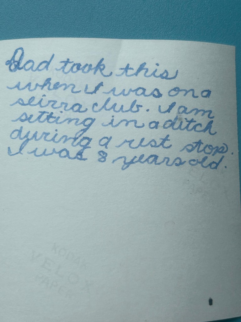
Kid Catwater on a Sierra Club hike in CACan’t believe how good my cursive was
It’s weird being done with the PCT, CDT and AT. What next? A few years ago when I was back at Doc Campbell’s in New Mexico on another “warm up” section hike, a Grand Enchantment Trail (the GET) hiker was also there, hanging with the CDT hikers, before he resumed his east bound hike to Albuquerque. He laughed and said, “The GET is where Triple Crowners go to die.” Meaning, I think, that once you’ve achieved Triple Crown status, you don’t stop hiking, you just find other challenges.
Anyway, after finishing the AT in 2023, I went back to the Sierra and hiked with my buddies Sunset, Lonesome Duck and Disco. It was a big snow year so even in July, a lot remained. I know it was a challenge for the 2023 NOBO PCT hikers and we met some on the trail who had delayed their starts from Mexico so as to not have to deal with too much snow travel.
I always enjoy these guys (even if one of them has an alternate trail name bestowed by Puff Puff in 2019, “my favorite grumpy old guy), and we chose to do a stretch of the JMT out of Red’s Meadow up to Lake Virginia and then back out to Mammoth via Duck Pass. We took a peek from the JMT down, down, down to Tully Hole and said, “nope.” The Tully Troopers we’re calling ourselves. There were surprisingly few JMT hikers so we had no problems finding campsites for our 4 tents.
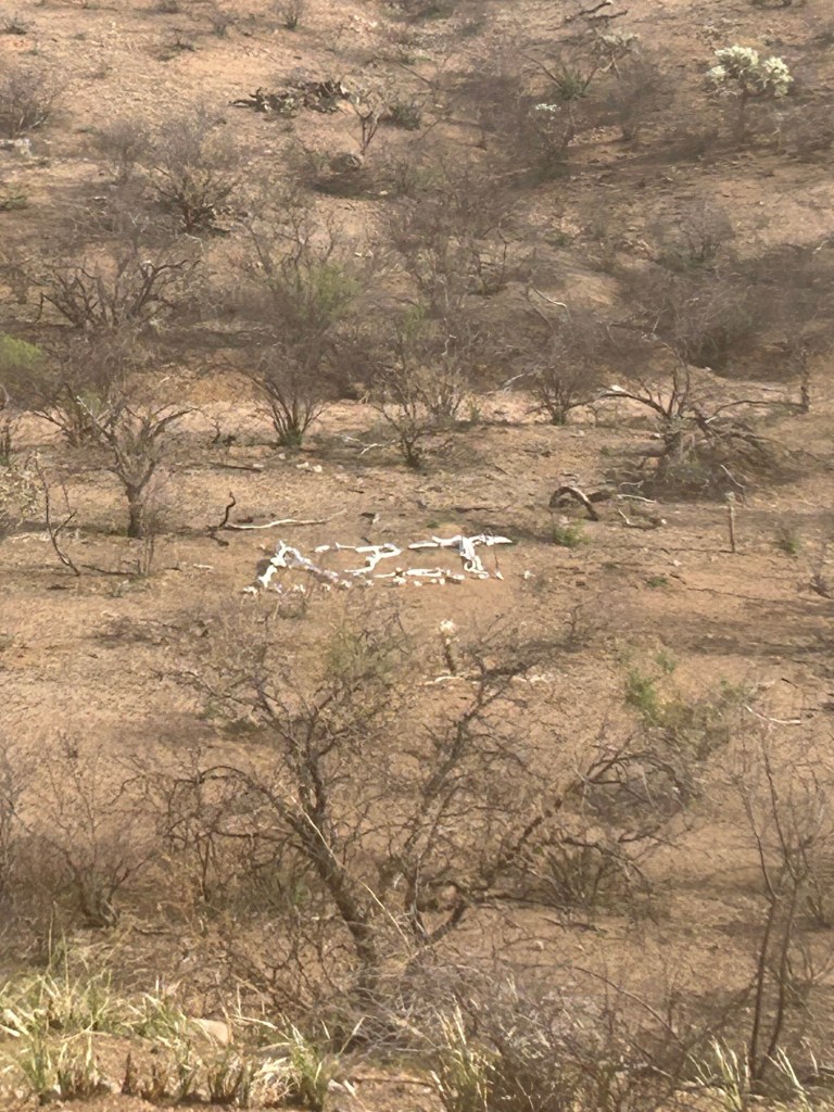
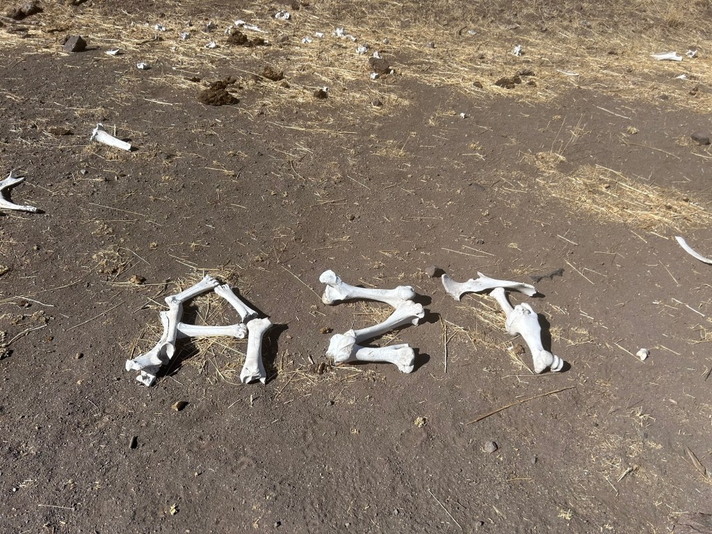
Dead or alive?
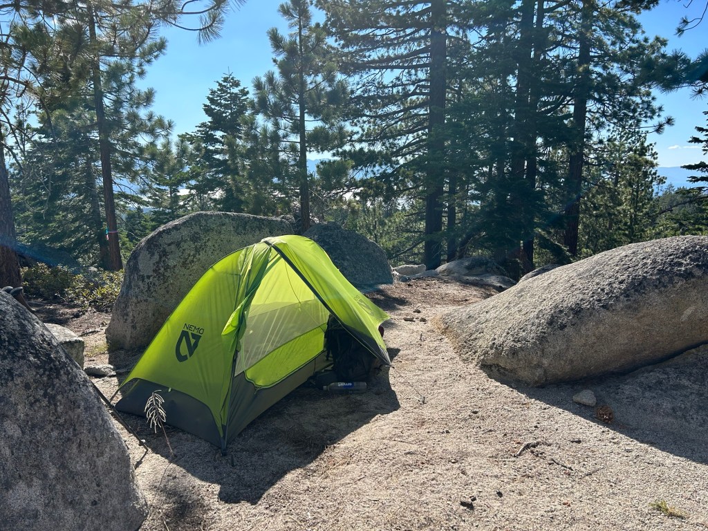
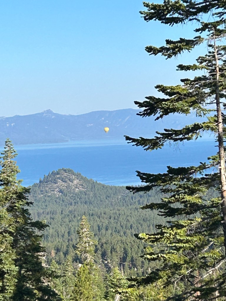
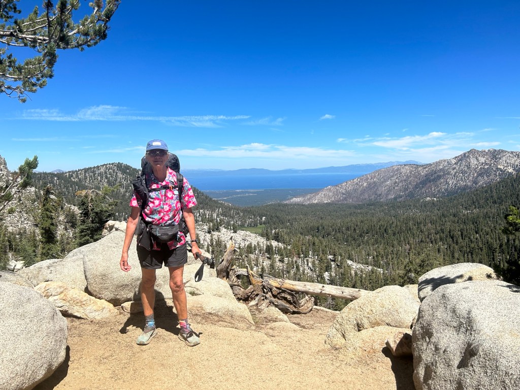
My next trek was scheduled around the Foo Fighters tickets I bought for a concert in Stateline, Nevada. The Tahoe Rim Trail (TRT) is about 175 miles around the lake, only about 50 miles of which don’t allow bicycles. Those 50 miles are collocated with the PCT. And there were a few rogue riders who ignored the trail etiquette of yielding to hikers. You can guess my reaction. And still, I loved this trail, non-stop beauty and Lake Tahoe views. Frequent access to resupply, so my pack wasn’t too heavy. And I was as acclimated because of the Tully Troopers hike at altitude. Lots of people, but I could live here anyway…
Corey who taught me how to e-bikeDead dirt bikeCatwater and Corey at Dick’s PassLake Aloha
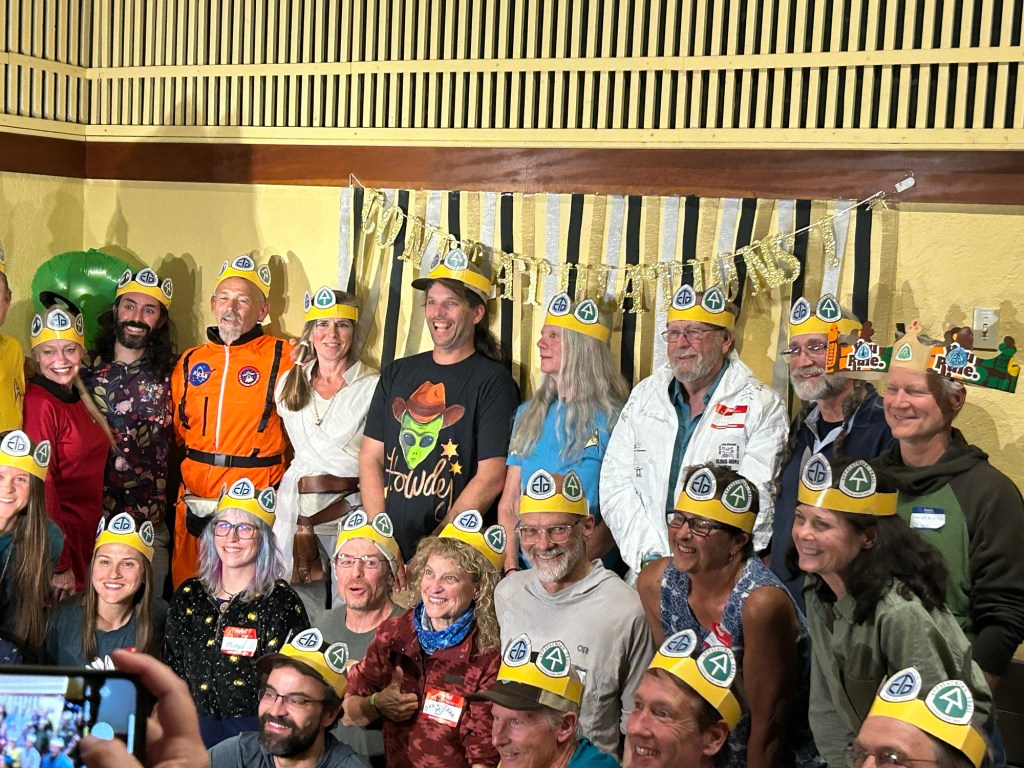
ALDHA-West Triple Crown of Hiking ceremony!!! Near Mount Hood, Oregon, September 2023.
2023-2024 Snowboard interlude
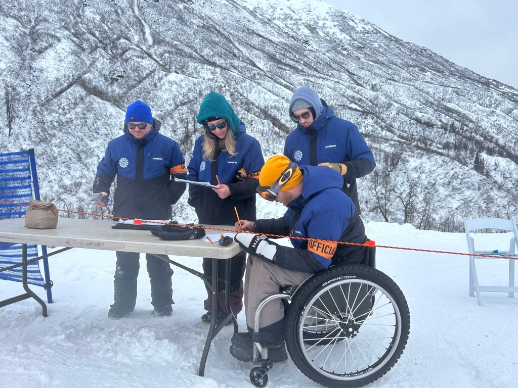
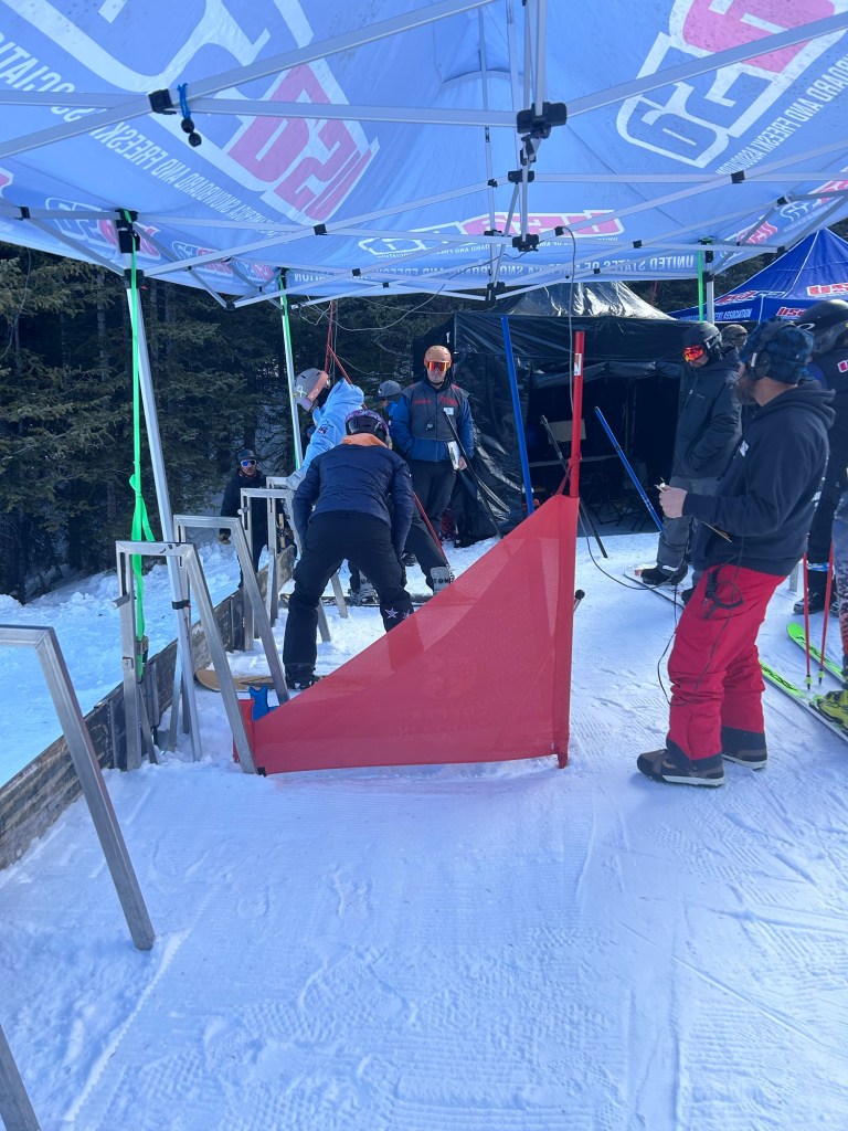
USASA Big Alaska Hilltop Ski Area Rail JamYukon, Alberta and Alaska Rail Jam judges at Arctic Winter Games at Skeetawk: l to r Rob, Harmony, Kris, DarrylNorm from Yukon troubleshooting AWG Snowboard Officials transportationMy Copper Mountain, CO office for a couple weeksOlympic gold medalists forerunning the Boardercross course at USASA Nationals at Copper Mountaib. Thanks Nick and Lindsey!What Alaska girls do at Nationals when they’re not on their snowboards Ask USASA ED Mike Mallon about bambams in USASA goodie bags 😹
Later in April, back to the CDT in New Mexico to get in hiking shape for the Grand Canyon.
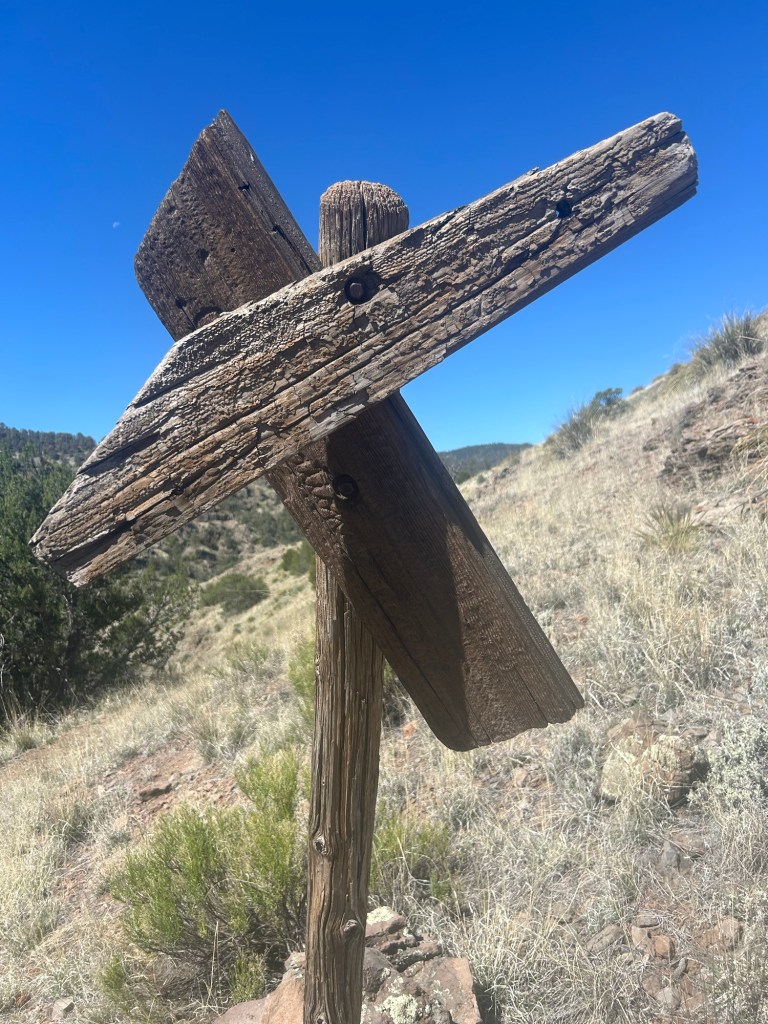
Helpful signage on a trail new to meKnight Shift from the PCT 2015, totally unexpected encounter on Mangas Mountain, New Mexico. Highlight of the hike!
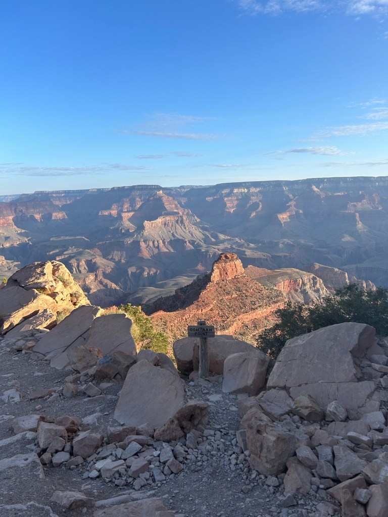
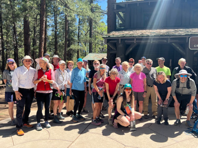
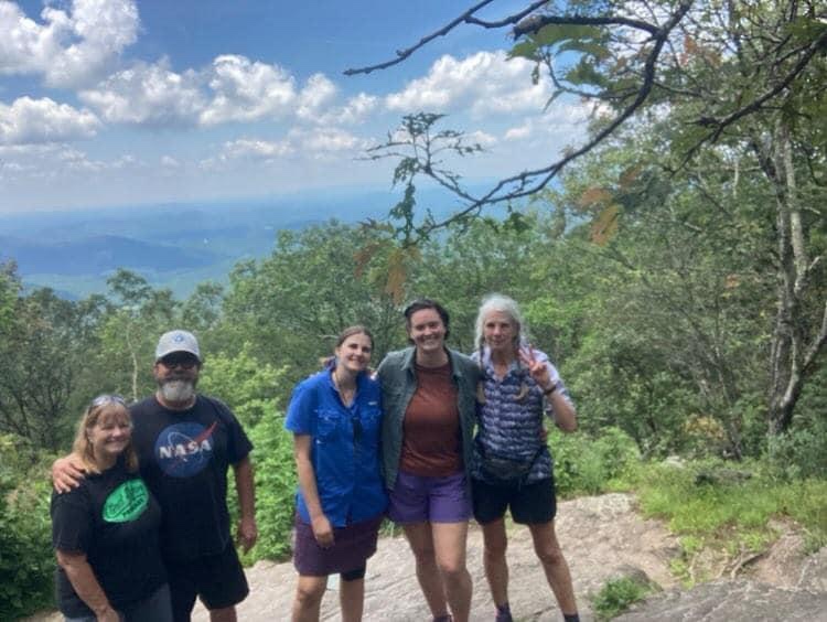
Grand Canyon
Grand Canyon hikers: Alaskans, relocated Alaskans and friends of AlaskansMerrideane and Leslie I want to raft the Colorado
We gathered at lodging on the South Rim the day before dayhiking rim to rim. The plan was 8 miles down the South Kaibab Trail, then 14 up the North Kaibab. It was a beautiful day, incredible scenery every minute of the long day, and really hard work. Some in our group finished in about 11 hours, others in more than 15 hours. I was around 12 1/2 with plenty of microbreaks. Water wasn’t an issue, there are potable water sources, which is good but kinda freaky, and natural sources which I’m used to.
Charles was waiting for a van load of hikers to gather at the trailhead and drive us the 2 miles to our lodging on the North Rim, thanks again, Charles! I checked into my cozy cabin and got a call from friend Steve McKeever from the cafeteria. “Better get over here, they’re running out of food!” I managed to make it in time to eat, whew.
We all took a zero the next day but gathered at the General Store for snacks and the group photo. My legs were killing me, so I decided not to hike back the following day, reasoning when I did the Arizona Trail SOBO in the Fall, I’d get to anyway. Yeah right, what a wimp. Instead I got a 5 hour car ride with Merrideane and Leslie back to the South Rim. Great conversation and views, no regrets!
Next? After some time off I will go back to New Mexico for the 500 mile Northern New Mexico Loop which starts and ends in Santa Fe and includes about 150 Continental Divide Trail (CDT) miles that I’ve hiked previously.
This trail scares the snot out of me. So why do it? And how? And why?
My main motivation is dumb really, I want the Triple Crown of hiking. The rain, the brutal trail rocks, the ups and downs without switchbacks, the crowds, the frequent towns, I have to immerse myself in a new hiking culture and try not to compare it to other trail cultures. That’s the true challenge, mentally reorienting myself. Will I become part of a so-called trail family, a “tramily?” Will I hunker for days in a hostel because I can’t face hiking out in rain? Well maybe if it’s warm rain, I’ll hike out, humidity doesn’t bother me, cold does. (I know, I know, I’m Alaskan, I surely love the cold and dark, right?)
I’ve been so accustomed to low numbers of humans on the CDT, enough companionship to make me happy but not so many as to make me nervous about filled up campsites or hostels in town.
I can’t start the AT till April 15. But what about weather and winter heading north in April? I just don’t know. I have a hard time leaving a nice comfy motel room when it’s raining and I think it rains a lot back East. I’ve become pretty good at figuring out logistics though. And I have a hiking umbrella with an extra long telescoping handle I can tuck into my pack for hands free hiking.
From social media it appears that huge numbers of prospective hikers know little about hiking or camping and live back East with the AT built into their conscience as a great thing to do. Attrition rate reaches 70% by the 1/2 way point. The PCT attrition rate is something like 50% by the end.
Why do it? The Ravens and Puff Puff, the people I’ve spent hundreds of miles hiking with, have commented in their blogs that I’d hate it. So I found a book, The Appalachian Trials, written for newbie hikers but applicable to me anyway, that says write a list of whys, laminate it, and read it on the trail when you feel in need of motivation. Top of my list, to get the Triple Crown of long distance hiking (PCT, CDT, AT) which is kind of lame but that’s my main motivator. Others: explore more history, give my snowboarding friends the chance to help me along the way while visiting their states, walk through new mountains, face my Northerner’s fear of the East, and experience the super hiker friendliness the people along the AT are known for.
The AT purist attitude is where the dumb “thru hike” phrase comes from, as in “I’m going to thru-hike a 31 mile section of the AT,” or “It’s not a thru-hike if you don’t… “. These people have yet to hear of the concept of connecting your footsteps even if not the actual blazed trail. Apparently somewhere there is a rule that you have 12 months to hike every foot of the current white-blazed trail in order to be a thru-hiker. I’m hiking the AT, I’m a long distance hiker, I intend to hike the entire AT, I connect my footsteps in an unbroken track, sometimes it will be wearing a daypack, sometimes I may take an alternate, and if a section of the trail is closed, for whatever reason, I won’t hike it.
The insanity of the social media sites devoted to discussing the AT is mind blowing. “What’s the best underwear?” “How many pairs?” Food storage is huge with people claiming their method is “perfect” and others countering with horror stories about said “perfect” method. Some people have never backpacked before and are building their entire kit from scratch and are understandably anxious and confused over what pack, bag, shoes or boots, tent or hammock, etc to get. “How many miles a day are you all going to hike?”
I started thinking about what scared me about other hikes I’ve done. I remember camping on my own many years ago, that scared me until I did it. My first PCT in 2015, I was terrified of starting in the desert at the Mexican border until I did it. Now I’m terrified of overflowing shelters and tent sites, until I do it.
What does not scare me about the AT? Snakes, ticks, sidearm packing Southerners, bear, coyotes, day trippers, pitching my tent, running out of food, blisters, sprains, snow, hiking 10-hour days, or crappy IPAs.
Flip pages to the end of the mystery book— I did it! I finished the Appalachian Trail at Springer Mountain on July 12, 2023.
I’ve been ridiculously anxious the last couple hundred miles about something happening that would make me get off trail. Maybe it’s weird but I just wanted to complete this trail. This time it hasn’t been about the journey, it’s been about the achievement. For myself. I did it.
The weather north on the AT has been really bad, the flooding in Vermont has washed out at least one bridge, and caused hikers to slog through “Vermud” where they could. Hikers have been asked to get off the trail for their own safety. I was so lucky last year to have way better conditions, just a couple of days where I was wet, cold and miserable.
Meanwhile the record snowfall in the Sierra has been a massive challenge for people trying to thru-hike the PCT.
My decision to walk these last 470 miles from Damascus to Springer in June and July means I’ve been in the lush rainforest, the green tunnel with very few other hikers. If I’d continued last October I would have had better views since the trees and bushes are deciduous and drop their leaves in the Fall. Doh. But I wanted to finish the AT in time to apply to get the Triple Crown of Hiking at the Fall Gathering of the American Long-Distance Hiking Association-West (ALDHA-West) this September. I did it.
I’ve barely had to pitch my tent the last few weeks. I’ve taken advantage of the unique situation along the AT. There are numerous shuttle operations that will pick me up, drop me off and pick me up again and bring me back to a motel or hostel for a dry comfortable place to sleep. It takes quite a bit of cash but I’m no purist, as anybody who’s hiked with me knows. I connect my footsteps so I’ve not missed a mile. Platinum blazing has kept me injury free and given me the social connections that keep my anxiety at bay.
The Hidden Pond Hostel was the last place I stayed. I hiked off trail about 0.5 miles and Potholder picked me up for the short ride. Along with M&M and Pootz, he’s keeping the place open for hikers. Many hostels are closed now since the NOBOs are long gone. Two women I’d met briefly a day or two previously, Strider and Feral, were staying there on their section hike from Hiawassee to Amicalola State Park just past the Springer terminus. Sitting in the common area, I expressed my dream that I wouldn’t have to pitch my tent again, that there was a slackpack option to get me 15 miles the next day, leaving just 9 for my last day. M&M and Pootz (2007 AT hikers) calmly started talking about it. And made it happen, yay!
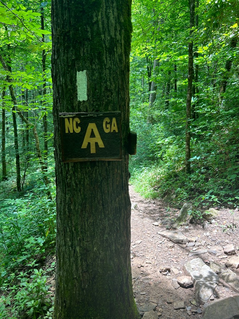
GA, the 14th of the 14 states the AT travels through Rock wall with culvert holding up the trailSpider webM&M, Pootz,Feral, Strider, Catwater celebrating at the top of SpringerM&M made me this sign!
P.S. I wrote a little essay in 2019 after I finished the CDT about hiking the AT in 2020. Which I didn’t do that year because of the pandemic. It follows this post, unedited.
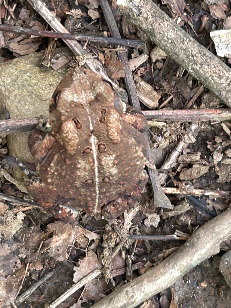
I took a zero. Seems like every 5 or 6 days I just don’t feel like slogging down the trail all day. It really gets tedious actually, especially with the gray skies overhead and surrounded by wet, green vegetation. What does it mean when I start counting centipedes and then refine that to include which direction across the trail each is traveling?
This is an endurance event for sure. I picked this time of year to finish these last 470 miles to avoid crowds of NOBOs (north boulders) and to finish the AT in time (mid-August) to report to the American Long-Distance Hiking Association-West (ALDHA-West) and officially earn the Triple Crown of Hiking. It’s also the time of year when all the trees and bushes have their view shrouding foliage. Fall would have views, oh well.
The walking is hard of course, but not really hard. I mean I get assorted aches and pains, I get tired, I slip and fall, I get cold and wet. There are hikers out for a few days, not a lot, but nice to see them.
What a strange world I’ve created. Hike, boring and tedious, then get a shuttle to comfort. Only on the AT! Fontana, then Gorgeous Stays near the NOC, then Franklin and so on….
Anyway, my hike has recently been about wonderful shuttle providers and places to stay inside. “Platinum blazing” is getting me down the trail. There are drivers listed in the FarOut app who will pick me up, take me to a trail head, pick me up at a designated road access trailhead at the end of my day, then take me back to wherever I’m paying to stay. And then the thunder showers commence. It’s a cash transaction. Without exception, every driver has been prompt, courteous and professional. I’ve tried to stay at hostels that support hikers, but many are taking a break at this time since the NOBO bubble has passed through and there’s just a few hikers needing their services. So I’ve found hotels. I wanted to avoid the crowds and so I have. A bit lonely, but also rather pleasant to have these beautiful woods to myself. I’m happy to be here.